Banana Leaf Travel contains affiliate links. If you book through them, I may earn a small commission at no extra cost to you. I only recommend services I personally use and trust.
How To Hike Gunung Raya: The Highest Point Of Langkawi, Malaysia
Modified on
The highest point of the Langkawi Archipelago is reachable by car, but if you’re an avid hiker there is only one way up: The Thousand Memories Eagle Stairs.
I’ve decided to tackle Gunung Raya by trekking through the heart of the jungle too. And let me be honest, it was a humbling experience.
It tested my limits, and while I don’t regret a single step, I definitely wish I’d known a few things before I started.
Well, if you’re looking for an easy walk, this isn’t it. But if you want an adventure, that connects you with the wilder side of Malaysia, keep reading.
I’m breaking down everything you need to know to survive the 4,287 steps climb and safely reach the peak.
Gunung Raya Hike at a Glance
How to Get to the Gunung Raya Trailhead
Gunung Raya mountain is located right in the center of Langkawi.
The path starts in a small riverside park where locals go to swim.
Skip Google Maps here. It only recognises the 13km paved road for cars.
For the actual jungle staircase, use Maps.me or AllTrails – they show the exact route through the canopy that Google misses.
The Stats at a Glance:
- Total Steps: 4,287
- Distance: 3.1 km (One way)
- Elevation: 787.8 meters
- Estimated Time: 2 hours 15 minutes (Allow more for the humidity)
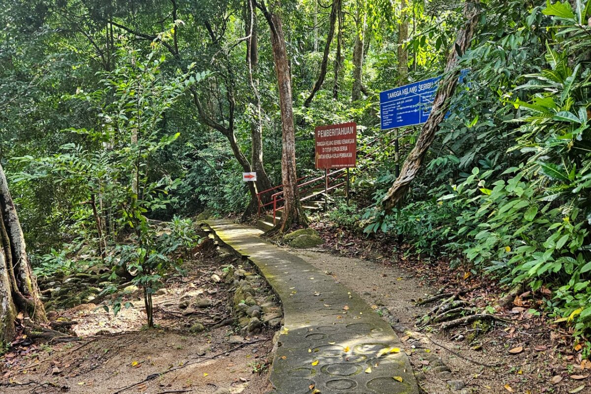
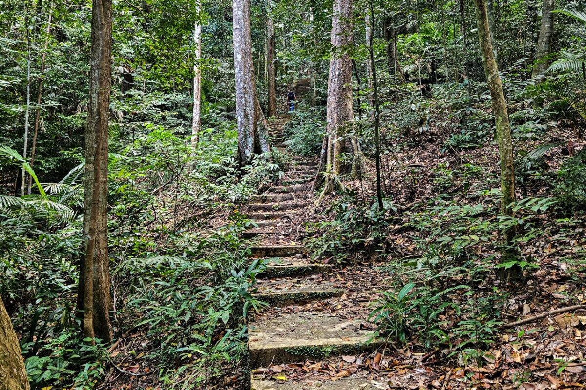
On the Trail: Navigating the Jungle Stairs to Gunung Raya
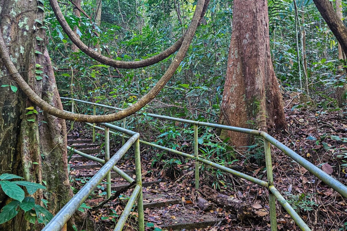
The path to the top is essentially a massive concrete staircase being slowly reclaimed by the rainforest.
The real challenges are the heat, humidity, and mosquitoes.
I had to stop several times to catch my breath, drink water, and motivate myself to keep going.
It is essential to give yourself enough time, stay hydrated, and bring snacks, as there are no shops along the way.
You will sweat a lot, so wear breathable, moisture-wicking clothes.
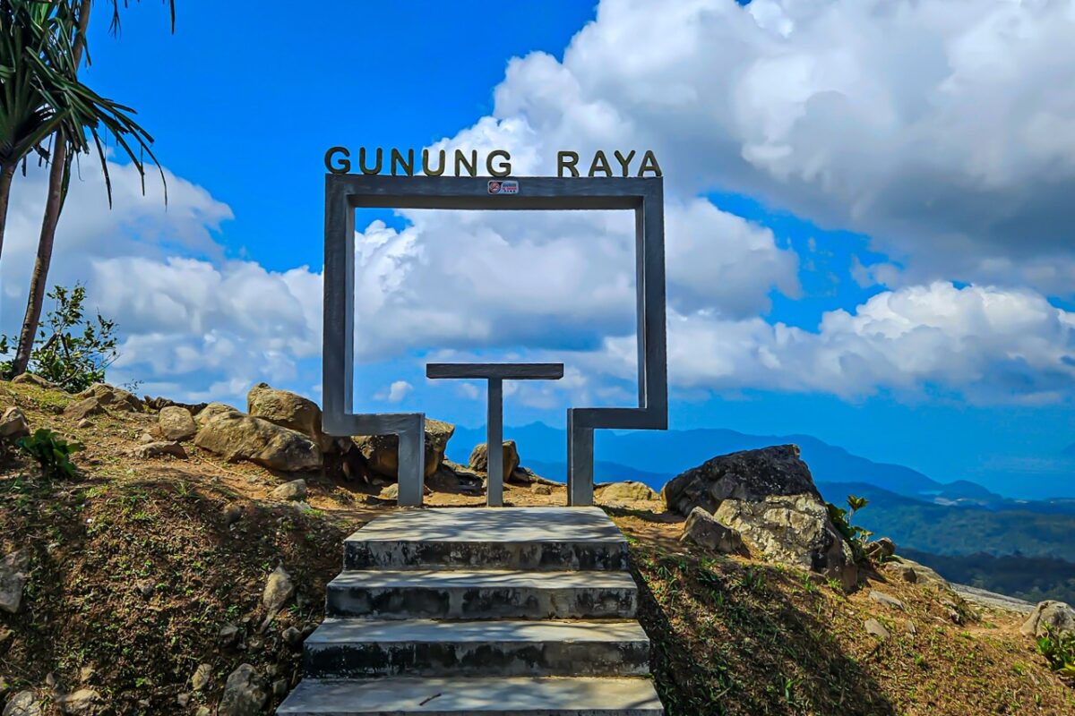
The Summit: Reaching Langkawi’s Highest Point
After the long climb, you’ll find a rope section right at the end of the stairs.
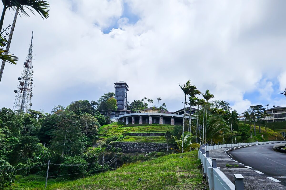
The summit of Gunung Raya itself is a bit strange.
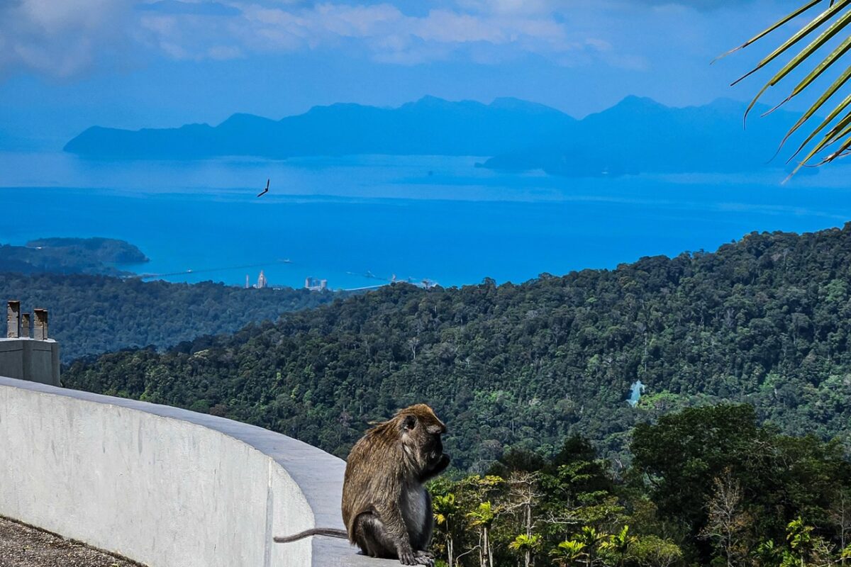
You will be also likely to spot many monkeys near the car park. As always, be respectful of the local wildlife and keep a safe distance!
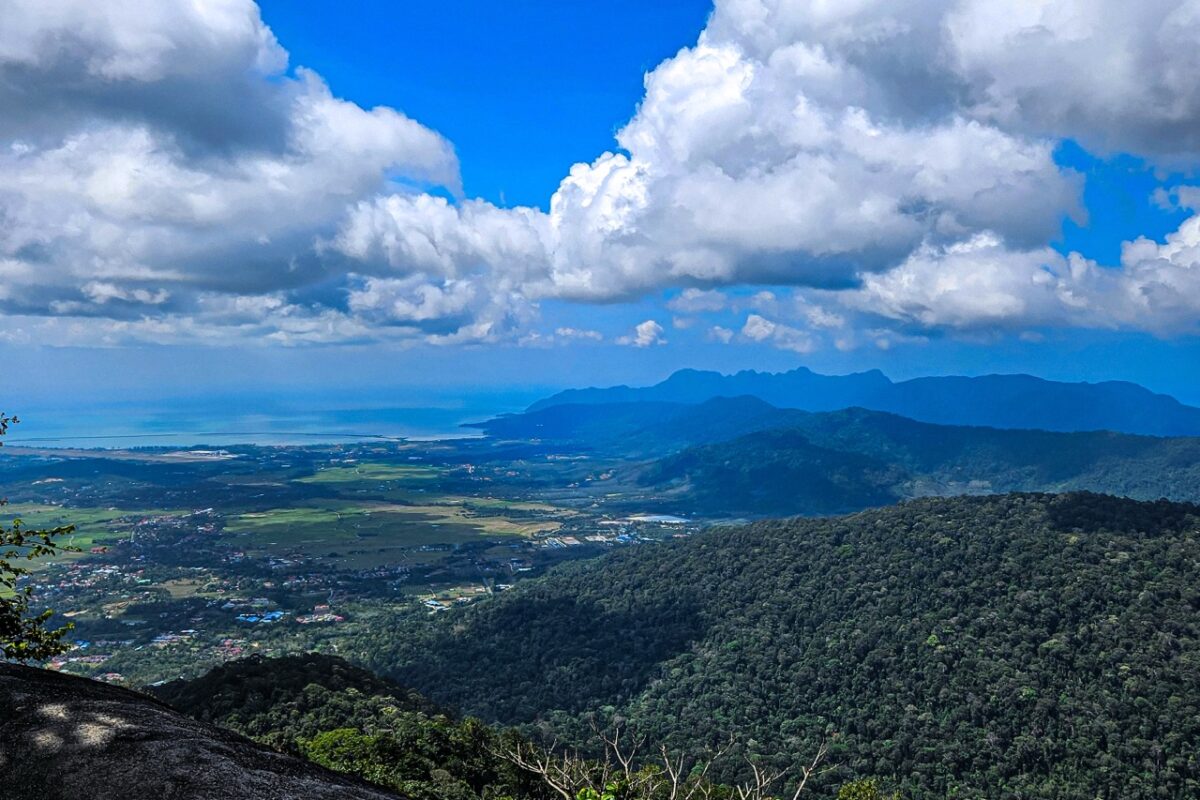
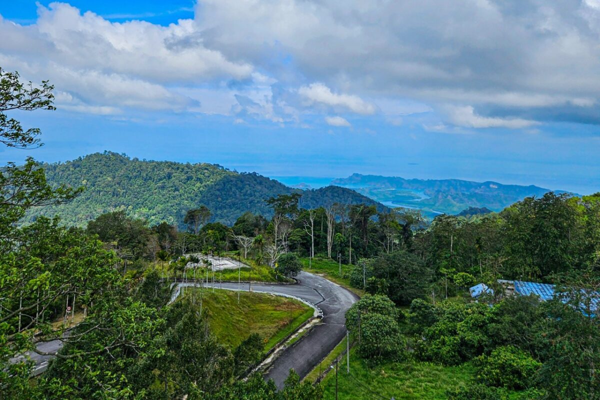
Luckily, the views are magnificent and a huge reward after the climb.
You can see Langkawi’s jungle-covered hills and the picturesque coastline stretching out below.
Don’t get stranded at 787m with no signal. I use an Airalo eSIM because you absolutely need a stable data connection to stay safe while jungle hiking!
The Legend Of The Gunung Raya Mountain
This spectacular mountain isn’t just a pile of granite – it’s also an interesting piece of Malaysian folklore.
Geologically, it’s just as impressive. Gunung Raya is a massive granite dome that pushed its way up through the earth about 220 million years ago, making it some of the oldest land in Southeast Asia.
Langkawi’s Wildlife To Spot Along The Way To The Top
The Gunung Raya rainforest is over 200 million years old and packed with incredible biodiversity if you keep your eyes peeled:

The Descent: Finding Way Back Down The Mountain
We reached the summit around 2 PM, completely drained by the midday heat.
Skipping the hike back down was an easy decision, but getting a ride was a mission of its own:
Side note: We had zero luck hitchhiking back down.
Plenty of people drive to the top, but after several failed attempts to catch a ride, we realised it isn’t a reliable strategy.
This is where having an Airalo eSIM saved us. Because we had a solid data connection we could research other options and even download InDrive app.
Obviously, if you are not short in time, you can easily head back down the same way you came up.
What to Pack: Don’t Hike Without These
| Item | Why You Need It |
|---|---|
| 3L of Water | No shops or refills available; humidity makes dehydration a real risk. |
| High-Protein Snacks | Energy bars or nuts to fuel the grueling 4,287-step climb. |
| Offline Maps | Use Maps.me or AllTrails as mobile signal is weak in the canopy. |
| Quick-Dry Clothes | Moisture-wicking gear only; cotton stays soaked and causes chafing. |
| eSIM or local SIM card | Essential for staying safe and booking your ride home from the peak. Airalo eSIM worked best for me. |
| Head Torch | Essential for sunrise hikes to keep hands free for the rope section. |
| Hat / Headgear | Protects from ticks in the jungle and the harsh sun at the exposed summit. |
| SPF 50+ Sunscreen | The summit is completely exposed; re-apply before leaving the forest shade. |
| Bug Spray | Crucial for the humid lower sections where mosquitoes are most active. |
| Anti-Leech Kit | Salty water spray, long socks, and bandages to handle jungle hitchhikers. |
FAQ: Common Questions About Hiking Gunung Raya
No. The trail is a set of stairs, so it is impossible to get lost. It is perfectly suited for a self-guided trip.
No, the trail is currently free to access.
The trail is easy to follow, but it’s isolated and the stairs are often broken. It’s safer to go with a partner in case of injury, as there is very little foot traffic and weak mobile coverage.
There is no public transport. You can try to hitch a ride with tourists at the car park (although we weren’t lucky) or use the InDriver app
The dry season in Langkawi (November to March) is best. You’ll get clearer views and avoid the dangerously slippery moss and mud that comes with the rain.
If you bought eSIM like Airalo or a local SIM card, you won’t have problem with getting signal. But don’t rely on your roaming data, as it wasn’t working for us.
Final Thoughts: Is It Worth Hiking Langkawi’s Highest Point?
Looking back, the Gunung Raya hike was one of the most physically demanding but rewarding things I did in Langkawi.
That being said, it is definitely a battle against 4,000 steps and a lot of humidity.
If you are looking for an adventurous experience that gets you off the beaten path, away from the queues and crowds, this is it.
It’s raw, it’s authentic, and it’s the perfect way to see a side of Langkawi that most tourists completely miss.
Plus, apart from the cost of transport, it is a completely free activity!
Just bring more water than you think you need, wear your best quick-dry gear, and be prepared to earn that view!
Read My Other Hiking Guides
- 14 Top Adventurous Experiences in Southern Thailand and Where to Find Them
- Guide to Jungle Trekking in Southern Thailand
- 11 Best Hikes on Koh Phi Phi Don, Thailand – Detailed Guide
- How to Do Coastal Hike to Long Beach (Haad Yao) on Koh Phi Phi – Detailed Guide
- How to Do Jungle Hike to Loh Ba Kao Bay on Koh Phi Phi – Detailed Guide